GEOTECHNICALENGINEERING1
POMONA
HomeGeophysicsSeismic tomography (refraction/reflection)

Seismic Tomography (Refraction & Reflection) in Pomona

Rigorous testing. Clear reporting.

LEARN MORE

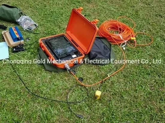
Pomona sits at the eastern edge of the Los Angeles Basin, where the San Jose Fault runs through the city and the alluvial sediments of the Pomona Valley can mask dramatic lateral velocity changes within just a few hundred feet. ASCE 7 requires site class determination, and the IBC mandates that soft soil profiles be identified before structural design begins. Seismic tomography (refraction/reflection) gives us a continuous 2D or 3D image of compressional and shear wave velocities, so you can see exactly where the bedrock drops, where a paleochannel cuts through the site, or whether that high-velocity spike at 40 feet is a boulder or the top of the San Antonio formation. Our field crew runs 24- to 48-channel spreads with a weight-drop or accelerated impact source, and we process the data with iterative ray-tracing algorithms that honor the actual curved ray paths through the soil column.
For deeper targets, we combine refraction with a MASW survey to get a Vs30 profile that feeds directly into the site classification, or we integrate the velocity model with liquefaction assessments when the groundwater table is shallow in the western part of the city near the 71 freeway corridor.

A dipping refractor missed by a standard 115-foot spread can shift your foundation design from spread footings to deep piles—and nobody wants to discover that during excavation.
Our service areas

Our approach and scope

The biggest mistake we see in Pomona is running a single 115-foot spread and assuming the velocity model is one-dimensional. The alluvial fans coming off the San Gabriel Mountains create dipping refractors—if the survey line is laid perpendicular to the dip, you get a false bedrock depth that can be off by 15 or 20 feet. We always shoot reciprocal forward and reverse spreads, and when the site geometry allows, we lay out overlapping lines so we can run a 3D tomographic inversion. That picks up lateral velocity gradients that a 1D Vs30 measurement will miss entirely.
Another common error is stopping the survey at 100 feet when the foundation loads from a mid-rise structure can influence soils down to 150 feet or more in the soft Pomona alluvium. We extend the spread length accordingly, and for reflection work on deeper targets—say mapping the top of the basement rock at 300 to 500 feet—we switch to a longer-offset acquisition with a higher-energy source. The processed P-wave and S-wave velocity sections then become the input for a site-specific ground response analysis that can justify a reduction in design spectral accelerations compared to the code default.
Seismic Tomography (Refraction & Reflection) in Pomona
Technical reference — Pomona

Local geotechnical context

Pomona's growth really took off after the 1950s, when the orange groves gave way to subdivisions and industrial parks across the valley floor. Much of that early development predated modern seismic codes, so the subsurface data from that era is sparse and often limited to boring logs with no geophysical velocity information. Today, when a developer wants to put a four-story mixed-use building on a lot that's been vacant since the 1970s, there's rarely a reliable Vs profile on file. The city's proximity to the San Jose and Claremont faults means the seismic hazard is real, and the site amplification in the soft alluvial deposits can push spectral accelerations well above the mapped values if you don't have site-specific velocity data. A seismic tomography survey here isn't just a box to check—it's what tells you whether the site is Class D or Class E, and that single classification can change the seismic base shear by 30% or more. We've worked on projects near Fairplex and along Holt Avenue where the velocity contrast across a single lot was enough to require different foundation types on opposite sides of the building footprint.

Need a geotechnical assessment?

Reply within 24h.

Email: info@geotechnicalengineering1.com

Relevant standards

ASCE 7-22 (Minimum Design Loads and Associated Criteria for Buildings and Other Structures), Chapter 20: Site Classification Procedure, IBC 2024 (International Building Code), Section 1613: Earthquake Loads, ASTM D5777-18 (Standard Guide for Using the Seismic Refraction Method for Subsurface Investigation), ASTM D7128-18 (Standard Guide for Using the Seismic Surface Wave Method, for complementary Vs30 determination), Caltrans Seismic Design Criteria v2.0, for transportation projects in the city right-of-way

Typical values

ParameterTypical value
Source typeWeight drop, accelerated impact, or sledgehammer (refraction); Betsy gun or small explosive (reflection)
Typical spread length115 to 575 ft for refraction; 300 to 1,500 ft for reflection
Receiver spacing5 to 20 ft depending on target resolution
Depth of investigationApproximately 1/3 to 1/5 of total spread length for refraction; variable for reflection
Output parametersVp, Vs, Poisson's ratio, dynamic Young's modulus, shear modulus, bulk modulus, Vs30
Reporting standardIBC 2024 Site Class (A-F), ASCE 7-22 Chapter 20, ASTM D5777 (refraction), ASTM D7128 (MASW reference)
Data formatSEG-2 or SEG-Y raw files, 2D/3D velocity sections in DXF or GeoTIFF

Common questions

What is the typical cost of a seismic tomography survey in Pomona?

For a standard refraction tomography survey with a 230-foot spread and 24 geophones, costs in Pomona typically range from US$2,400 to US$5,300 depending on the number of shot points, site access conditions, and whether we need to mobilize traffic control on city streets. Reflection work with longer spreads and a higher-energy source runs toward the upper end of that range or slightly beyond, especially if we're shooting multiple overlapping lines for 3D coverage.

How deep can seismic tomography see in the Pomona Valley soils?

For refraction, the rule of thumb is that the depth of investigation reaches about one-third to one-fifth of the total geophone spread length. With a 575-foot spread, you can typically image down to 115–190 feet in the alluvial soils common in Pomona. Reflection profiling can go much deeper—300 to 1,000 feet or more—depending on the source energy and the acoustic impedance contrast between the sediment layers and the basement rock.

Do I need both refraction and reflection for my project?

Not always. If you're designing shallow foundations or a basement less than 30 feet deep, refraction alone usually gives you everything you need: bedrock depth, rippability, and velocity for site classification. Reflection becomes valuable when you have a deep excavation, a tunnel alignment, or when the geotechnical borings suggest a complex buried channel geometry that refraction can't resolve because of a velocity inversion—where a soft layer sits beneath a stiffer one.

How does seismic tomography help with IBC site classification?

IBC site classification requires a Vs30 value—the average shear wave velocity in the top 100 feet. Seismic refraction gives you Vp directly, and we can convert to Vs using calibrated Poisson's ratios from the local geology. However, for a direct Vs measurement, we often run a MASW line along the same spread. The combined Vp and Vs dataset lets us compute Poisson's ratio, dynamic moduli, and a defensible Site Class (A through F) that can be submitted to the City of Pomona Building Department without pushback.

How long does a seismic tomography survey take, and will it disrupt my site?

A single refraction line with a 2-person crew takes about 2 to 4 hours on site, including layout, shooting, and breakdown. A reflection survey with multiple shot points might take a full day. The source—usually a weight drop or accelerated impact hammer—creates a brief thump at each shot location, but there's no drilling, no trenching, and no lasting disturbance. We can work on asphalt, compacted soil, or even landscaped areas with minimal impact.

Location and service area

We serve projects in Pomona and surrounding areas.

View larger map